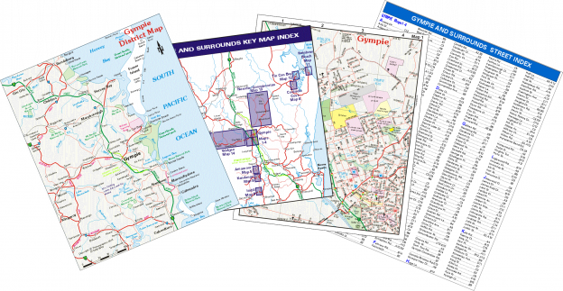
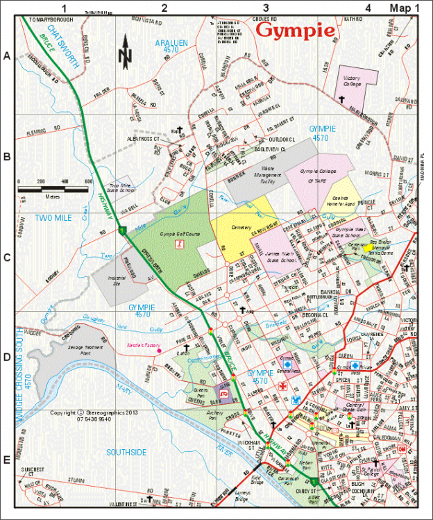
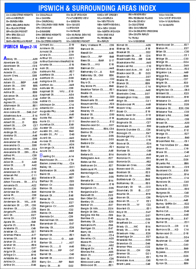
The Detailed Map shows either a part of a city/town or even a complete small town and is numbered identical to that shown on the Key Map. Suburb boundaries are shown along with rivers, streams, highways, major roads, minor roads and streets. Schools, hospitals and other services are also shown. Grids are provided with coordinates so that streets can be located from the Street Index if required.